Loading...


The initial programme of need, proposed for the Europan 4 competition, envisaged the construction of 356 dwellings on an area of 29,500 m2. This residential area was complemented by 8,700 m2 of commercial space and 16,100 m2 of tertiary use space, plus 4,400 m2 of social facilities. Naturally, road and parking facilities had to be resolved and the site had to be provided with green areas and outdoor public spaces.
View gallery
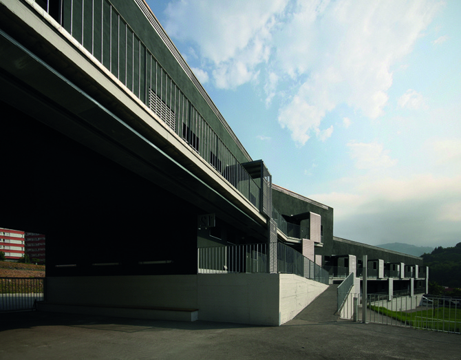
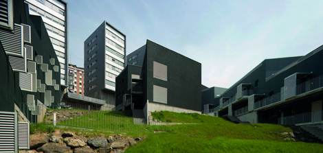
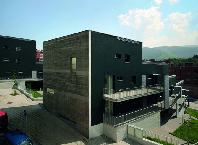
The site is located on the edge of the Sagarminaga neighbourhood -a heterogeneous group of housing buildings for the lower classes-, built in the fifties and sixties with a high building density and poor urban quality. The terrain was steeply sloping and had previously been occupied by a now disused mining operation, which had dug numerous galleries into the subsoil.
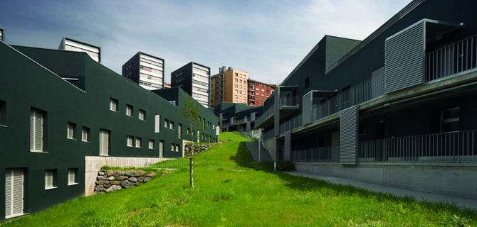
From the very first moment we were interested in the frontier character of the place, a no-man's land between the old town and the outskirts, between the river Nervión and the mountain, between nature and the city...
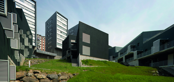
The project explored this ambiguous condition. Therefore, one of the operations investigated in the project was the manipulation of density to attend to the different conditions that were becoming present after the initial indeterminacy of the site, whose mixed-race nature has always been preserved.
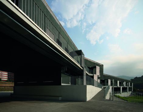
To meet the needs of the immediate vicinity, we proposed a fairly introverted, low-rise neighbourhood cluster, surrounded by a higher perimeter that concentrated tertiary commercial and amenity space, well connected to the neighbourhood. The existing, very dense neighbourhood was sponge-formed by preserving for public use two large, sunny, open spaces with distant views, and the open areas between the towers were conceived as urban viewpoints. In the heart of the cluster, the buildings are built on a carpet of green spaces, the roads are laid out in an inner ring, while the car parks are concentrated in the perimeter buildings.
General information
84 public housing units in Mina del Morro
YEAR
Status
Built
Option to visit
Address
St. Ortutxueta,
48006 Bilbao - Bizkaia
Latitude: 43.25062912
Longitude: -2.91941626
Classification
Civil
Built area
-
X BEAU -
X BEAU
Location
Click to activate the map
Built
Temporary
Lost
Unbuilt project
Docs
Itineraries
https://serviciosdevcarq.gnoss.com/https://serviciosdevcarq.gnoss.com//imagenes/Documentos/imgsem/44/44e6/44e65fe9-fed5-4c41-a9e9-f36073b891cf/9f260713-aa7a-4317-b4f8-16aa34ef7412.jpg, 0000006109/84 viviendas 1.jpg
https://serviciosdevcarq.gnoss.com/https://serviciosdevcarq.gnoss.com//imagenes/Documentos/imgsem/44/44e6/44e65fe9-fed5-4c41-a9e9-f36073b891cf/fad1c075-b9c4-404e-adb1-87c4c60d697b.jpg, 0000006109/84 viviendas 2.jpg
https://serviciosdevcarq.gnoss.com/https://serviciosdevcarq.gnoss.com//imagenes/Documentos/imgsem/44/44e6/44e65fe9-fed5-4c41-a9e9-f36073b891cf/65f42725-3dfb-4f40-bcc6-d137894d4af0.jpg, 0000006109/vivienda 3.jpg
https://serviciosdevcarq.gnoss.com/https://serviciosdevcarq.gnoss.com//imagenes/Documentos/imgsem/44/44e6/44e65fe9-fed5-4c41-a9e9-f36073b891cf/c3119676-23aa-4fd9-90bb-163fad6dbb93.jpg, 0000006109/vivienda 4.jpg
https://serviciosdevcarq.gnoss.com/https://serviciosdevcarq.gnoss.com//imagenes/Documentos/imgsem/44/44e6/44e65fe9-fed5-4c41-a9e9-f36073b891cf/645e5bfe-4484-42e0-83b9-6b35edd1933f.jpg, 0000006109/84 VPP EN LA MINA DEL MORRO f2.jpg
https://serviciosdevcarq.gnoss.com/https://serviciosdevcarq.gnoss.com//imagenes/Documentos/imgsem/44/44e6/44e65fe9-fed5-4c41-a9e9-f36073b891cf/f521a3fa-c917-472d-873a-9fba45bce37d.jpg, 0000006109/84 VPP EN LA MINA DEL MORRO f1.jpg

Schedule
Tuesday to Saturday: from 11 to 20 h.
Sundays and holidays: from 11 to 15 h.
La Arquería de Nuevos Ministerios
Paseo de la Castellana, 67
28046 Madrid - España


Horario
Martes a sábado: de 11 a 20 h.
Domingos y festivos: de 11 a 15 h.
La Arquería de Nuevos Ministerios
Paseo de la Castellana, 67
28046 Madrid - España
Design

Powered by

Copyright © 2024. All rights reserved.